First things first, just look at the rocks
Tim Cartledge, Managing Director, Cartledge Mining and Geotechnics
For geotechnical engineers, it’s easy to go straight for the detail, the data, and pour energy into what’s perceived, and known, to work best. In this article, Cartledge Mining and Geotechnics Director Tim Cartledge explores the simple yet often overlooked process of stepping away from the desk, getting out on site and just looking at the rocks – adding another dimension to the benefits of numerical modelling – to gain the fullest picture of what’s really going on.
How a simple solution can help solve complex geotechnical challenges
Data – it’s king for geotechnical engineers and pivotal in our work to ensure safety on a mine site. But while numerical modelling – being able to input raw information into a system that reliably spits out factors of safety and other vital measures – is a tremendous tool in our kit, there is invaluable power in a pair of legs and a pair of open eyes.
For those with a geology background, a walkaround on site may be a familiar process, yet for many geotechnics, especially those new to the field, it’s often untrodden ground.
The mine plans that geotechnical engineers influence are based on an understanding of rock mass strength and the orientation, continuity, and strength properties of these masses. While this understanding is undeniably gained through technology and digital modelling, adding a physical inspection element can only enhance an engineer’s analysis of material and wall strengths, improve resulting recommendations and, ultimately, boost mine site safety.
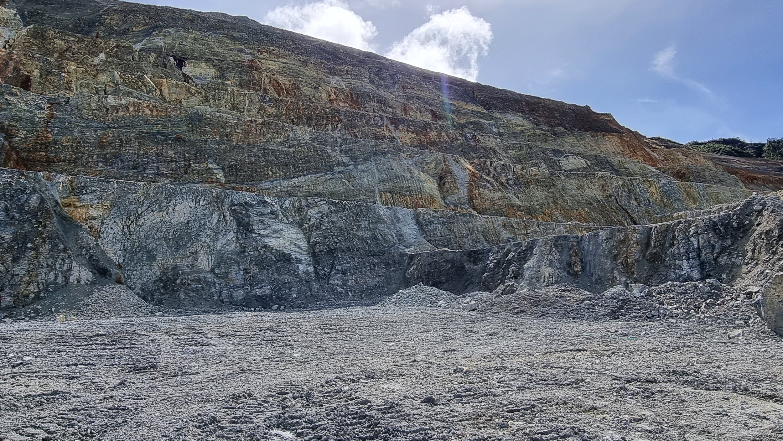
Back to basics with all eyes on the rocks
Structural geology describes and helps predict continuity of all rock discontinuities, such as joints, veins, and fault zones. It’s vital geotechnical engineers understand the nature of geological structures, and how to record them during mapping or drill core logging, to maximise their benefit as input parameters into analyses and designs.
And while this is a crucial set piece, visiting a mine site and spending time in the pit studying the walls and rocks is one of the most valuable tasks a geotechnical engineer can undertake. Doing so provides visual geological information about what’s currently happening on site and what could happen in future.
Up to 80-90% of the work geotechnical engineers do is understanding the geology and geological structure of a mine – the joints, faults, bedding planes and water flow. Understanding that in detail allows development of optimum operational and feasibility studies and solid advice on how to manage geotechnical risk on site.
Running numerical modelling alone, without understanding the geology of a site at a macro scale, can open up risk. Geotechnical engineers must understand how the tools we use, and the geology of an area, interact and behave to achieve outputs that are believable, consistent, and do not miss vital information that can lead to serious consequences such as slope failure, as well as cost and schedule impacts.
While significant slide and fall hazards are likely to be integrated into a mine plan, smaller naturally formed discontinuities in the rock can affect the wall stability, too, which can lead to rockfalls and slides. Not only is this a potential problem for employee injury and fatalities, but it can become very costly with regards to development of the resource. On a structurally complex site, these smaller instabilities can be easily missed via just a 60mm-diameter core analysis, which again justifies the need to get out there and just look at the rocks.
Maintaining a big-picture approach
Widening the lens of approach to a macro – not micro – level ensures a geotechnical engineer’s consideration of the bigger picture on site. But taking this view shouldn’t stop once the boots and hard hats come off.
Rather than diving straight down to the details on a micro scale, it’s pertinent to ask these questions: What are we trying to do? Given the site visit, is the digital analysis a true reflection of what we’re seeing in the field? How can we more accurately model the geology to better inform our design? How does what we have seen – how the pit and slopes behave and what the groundwater patterns and movements are – add to our understanding of the geographical domains and improve our design?
Thoughts in action on PNG site
During an inspection on a structurally complex mine site in Papua New Guinea last year, we identified – through physically looking at the walls – there was a lot of deformation and damage in one of the walls down to a certain level. Foliation in the schist rock had highlighted a pit-ward dipping plane of weakness in the rock mass, and the contact between the schist and the underlying granodiorite was displaying signs of shearing.
This early numerical modelling did not produce results that were consistent with our visual pit observations. The shear contact hadn’t been modelled correctly, so the model showed the walls were failing, which was not actually the case.
Once the shear contact was entered into the model, the results were far more consistent with what we saw on the ground – that beyond the wall damage, the geology improved and the wall stability and behaviour returned to normal.
In this case, as in many others, employing numerical modelling along with taking the time to understand the ground conditions, the geology, added that level of confidence required when doing a simulation.
Look, it’s a piece of the puzzle
Experience and results tell us we simply cannot underestimate the importance of spending time looking and listening to see and understand the big picture. Not doing so opens the door for inaccurate modelling and costly and dangerous decisions that risk lives on the ground.
Geotechnical engineers often deal with disparate pieces of information, and the nature of geology and the natural environment is very variable, so we must use every tool we have to help.
There is a tendency among engineers to place too much emphasis on the accuracy of numerical modelling, without considering the geology infrastructure and how those two work together to tell the right story.
Numerical modelling, while powerful, can be over-confidently used – it is there to help tell a story, but is not the whole story on what we expect conditions to do.
Visual inspection can only enhance this storytelling, providing a reliable piece to solving a challenging puzzle.
It may not be rocket science. It may seem simple. But just look at the rocks, it works.